Ocean, Freshwater and Us Map Poster
Ocean, Freshwater and Us Map Poster
Couldn't load pickup availability
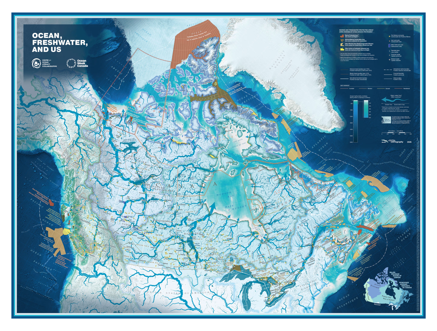
This beautifully designed poster map highlights the foundational connections between us and the ocean and freshwater that surround and sustain us. Co-designed by a national team of partners, it brings to light the connection we all have with water, regardless of where in Canada we call home.
Canada has the longest coastline of any country in the world and approximately 20 percent of the planet's freshwater resources. The map features Canada's watersheds with flow arrows showing the direction water travels to the ocean, Arctic sea ice extent, and a range of marine and freshwater protected areas. Villages, towns, and cities are included, along with particular illumination of Indigenous communities, treaties, and Indigenous languages spoken across the entirety of what we now call Canada.
Adapted from the Canadian Geographic Giant Floor Map of the same name, this poster version has been expertly designed as an art print. Cohesive colour palettes bring out the freshwater and ocean blues, making it perfect for framing in a home, classroom, or library.
Print specifications:
- Size: 26.75" × 19.75"
- Stock: 100# Opus Dull Text FSC, 10% post-consumer waste, manufactured acid-free for archival quality
- Printed waterless, VOC-free, using a 340 line screen
More about waterless printing technology:
This map is printed using waterless printing technology - a cleaner, greener process that eliminates the need for water in printing (conserving an estimated 200,000 litres annually), avoids the harmful chemical fountain solutions that contribute to smog, and actually produces a sharper, more vibrant image with superior clarity and depth. A fitting way to print a map celebrating the ocean.
Share